Boating, Fishing and Fish in the Tallapoosa River and Its Impoundments
The Tallapoosa River has a 4,675 square mile watershed. The watershed is mostly in the Piedmont, so it receives few nutrients from natural sources. For this reason, the Tallapoosa River and its reservoirs are often clear and not as productive as many of Alabama’s waters. The Tallapoosa River begins in Georgia and flows through eastern Alabama. All sections of the Tallapoosa and Little Tallapoosa rivers are determined navigable, which means the bottom of the streams is property of the State of Alabama. Four impoundments are formed from the Tallapoosa River before it joins the Coosa River near Montgomery to become the Alabama River.
Headwaters, the Upper Tallapoosa River and Little Tallapoosa River.
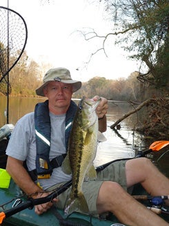
The Tallapoosa River has its headwaters in Georgia forty miles west of Atlanta and enters Alabama at Cleburne County. The Little Tallapoosa River also begins in Georgia and enters Alabama to form the border between Cleburne and Randolph counties. The two rivers have three types of black bass: largemouth bass, redeye bass and Alabama spotted bass. A variety of sunfish (bream) may also be caught in the clear waters.
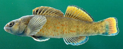
Various nongame fish are also present in the Tallapoosa River. The lipstick darter is unique to the Piedmont streams of the Tallapoosa River drainage. The stippled studfish is found in the Tallapoosa drainage and one Coosa River tributary, and the Tallapoosa shiner is only found in the Tallapoosa drainage and one Chattahoochee River tributary. The Tallapoosa River above R. L. Harris Reservoir and the Little Tallapoosa River have nearly equal watersheds; they merge at R. L. Harris Reservoir, also called Lake Wedowee, and continue as the Tallapoosa River.


