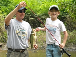
Fish and Fishing in Flint Creek of North Alabama
Flint Creek is a slow flowing, meandering stream impacted by the fluctuating water levels of Wheeler Reservoir. Flanking the stream are bald cypress, water oak, river birch, black tupelo, sweet gum, sycamore, and other hardwood trees. Many old trees have succumbed to the affects of erosion and have fallen into the creek, making boat navigation difficult, but providing extremely good fish habitat. Rock bluffs are present in sections of the stream, while other portions have shallow swampy overbank areas. Some sections of Flint Creek are wild and undeveloped, while the upper reaches of the creek drain agricultural land comprised of livestock, poultry and row crop farms.
Flint Creek and its tributaries comprise 150 miles of streams draining 291,000 acres of land in Cullman, Lawrence, and Morgan counties of North Alabama. With its headwaters in north Cullman County, Flint Creek flows northerly into Morgan County. After converging with West Flint Creek near US Highway 31, Flint Creek continues northerly through Wheeler National Wildlife Refuge, and past Decatur’s Point Mallard Park to its confluence with the Tennessee River at mile 308.5.
Navigating Flint Creek can be difficult due to the abundance of trees that protrude into the creek. Anglers that successfully weave their way through the myriad of trees can expect excellent crappie fishing. March and April are the best months of the year to “bag” a mess of crappie from Flint Creek. The abundance of boat trailers at the US Highway 31 Access Area near Hartselle testify to the quality of crappie fishing that the creek has to offer.


