Boating, Fishing and Fish in the Coosa River and Its Impoundments
Introduction
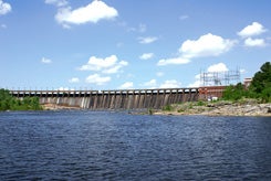
The Coosa River watershed begins in Tennessee and Georgia before entering Alabama at Weiss Lake. The water is naturally fertile and receives additional nutrients from various forms of land use within the watershed. Only a small portion of the Coosa River flows freely. Six Alabama Power Company dams impounds the waters of the Coosa River before it meets the Tallapoosa River to form the Alabama River: Weiss Lake, Neely Henry Lake, Logan Martin Lake, Lay Lake, Mitchell Lake and Lake Jordan. NOAA has guage heights. Alabama Power Company provides information 24-hours each day on scheduled water releases and lake levels by Internet or dialing 1-800-LAKES-11.
The watershed of the Coosa River occupies five different physiographic regions. The headwaters of the Coosa River are formed in the Blue Ridge Mountains and Cumberland Plateau. A third of the basin is in the Valley and Ridge, and another third is in the Piedmont. A small portion of the lower Coosa River flows in the Coastal Plain before meeting the Tallapoosa River to form the Alabama River. The high diversity of the geology is matched by the high diversity of endemic aquatic animals: fishes, mussels, snails and crayfishes.


